Geography of Prince George: rivers, plateau and forest
Where Prince George sits: the Fraser–Nechako confluence, the Interior Plateau, sub-boreal spruce forest, Tabor Mountain, lakes and the Arctic divide.
Updated
At a glance
- Prince George sits at about 53.9° N, where the Nechako River joins the Fraser, BC’s longest river at about 1,375 km.
- Downtown lies at roughly 575 m above sea level; the airport on the plateau above is at about 691 m.
- The city covers about 317 km² of the Nechako Plateau, part of BC’s Interior Plateau.
- It is surrounded by sub-boreal spruce forest of spruce, pine, fir, aspen and birch.
- Less than an hour north, Summit Lake sits on the divide between Pacific and Arctic drainage.
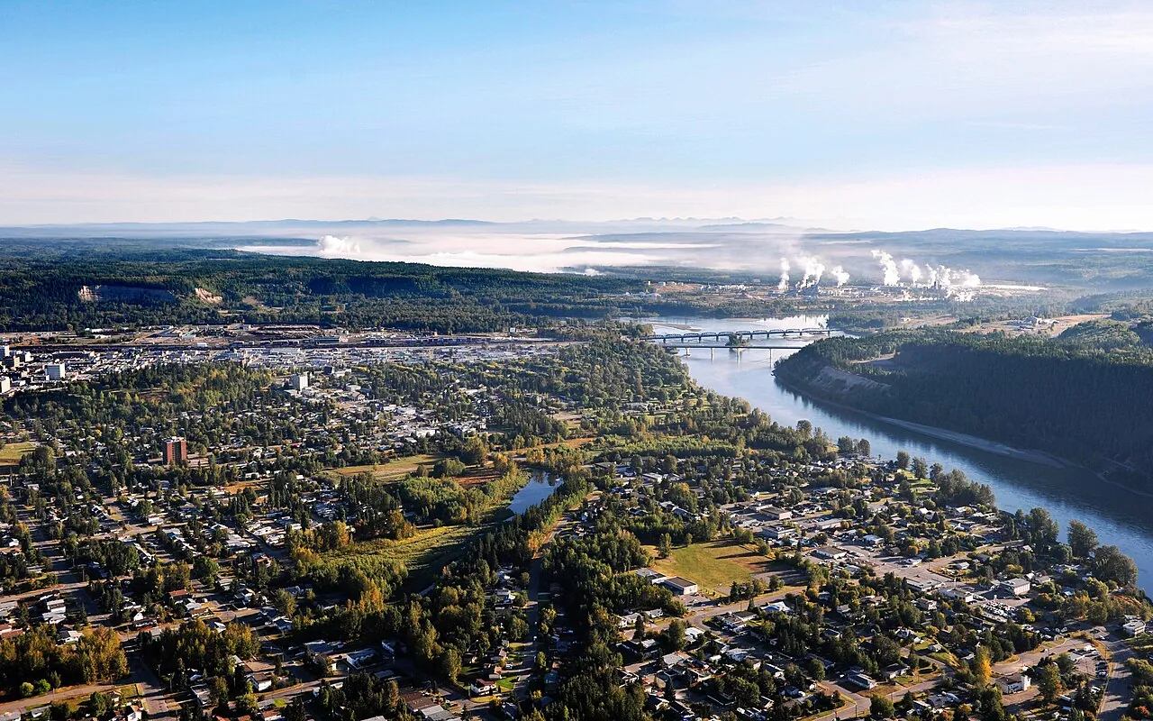
If you look at a map of British Columbia, Prince George sits almost exactly in the middle: roughly 780 km by road north of Vancouver and close to the geographic centre of the province, at about 53.9° N, 122.7° W. Its geography explains much of its history. Two major rivers meet here, forest stretches in every direction, and the land is flat enough to run railways and highways through.
The confluence
The Fraser River
The Fraser is British Columbia’s longest river, running about 1,375 km from Fraser Pass in the Rocky Mountains to the Strait of Georgia. It drains roughly 220,000 km², about a quarter of the province. Upstream of Prince George it flows northwest through the Robson Valley and the Rocky Mountain Trench, then makes a sharp bend near the Giscome Portage and turns south. At Prince George it picks up the Nechako and heads for the Pacific, eventually carving the Fraser Canyon far downstream.
The Nechako River
The Nechako rises on the plateau east of the Coast Mountains and flows north and east past Vanderhoof to join the Fraser here. Its name comes from Carrier words meaning “big river.” Since the Kenney Dam was completed in 1952, much of its upper flow has been diverted west through the mountains to generate power for aluminum smelting at Kitimat, which reduced flows and has affected salmon and sturgeon. Major tributaries include the Stuart River and the Chilako River, which enters about 15 km west of the city.
Living with the rivers
The rivers have shaped the city in many ways:
- Flooding. The spring freshet usually peaks in late spring. Low areas near the confluence, including Cottonwood Island Park, have flooded in high-water years and during winter ice jams.
- Ice jams. In December 2007 an ice jam on the Nechako grew to many kilometres long, flooding low-lying industrial and residential areas and prompting a state of emergency.
- Drinking water. The city’s water comes from wells drilled into gravel aquifers beside the rivers.
Live water levels and flows are on our rivers dashboard.
The plateau and the bowl
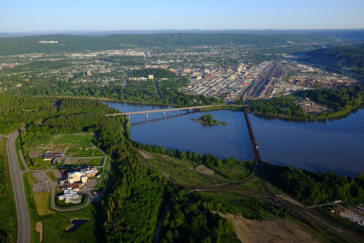
Prince George is built on the Nechako Plateau, the northern part of British Columbia’s Interior Plateau, a gently rolling upland of old volcanic and sedimentary rock smoothed by ice. The rivers have cut a broad valley, the bowl, into it. Most of the older city lies on the valley floor, while newer neighbourhoods have climbed onto the benches and plateau around it.
| Place | Approximate elevation |
|---|---|
| Downtown and the bowl | 575 m |
| Prince George Airport (YXS) | 691 m |
| Tabor Mountain ski area, top | 1,040 m |
To understand how the bowl and cutbanks formed, read Glacial Lake Prince George.
Hills and mountains around the city
- Cranbrook Hill rises on the west side and is home to UNBC and the Forests for the World trail network.
- Tabor Mountain, about 20 km east along Highway 16, hosts a small ski area with 255 m of vertical.
- The Rocky Mountains line the northeastern horizon, beyond the Rocky Mountain Trench.
- The Cariboo Mountains begin to the southeast and rise toward Barkerville and the Bowron Lakes.
From the Forests for the World lookout you can see much of this at once.
Forest
Prince George lies in the sub-boreal spruce forest, a mixed northern forest suited to cold winters and warm, short summers. Common trees include:
- Hybrid white spruce and subalpine fir, the classic dark conifers of the region.
- Lodgepole pine on drier, sandier ground. Huge areas were killed by the mountain pine beetle in the 2000s.
- Douglas-fir on warmer slopes, here near the northern limit of its interior range.
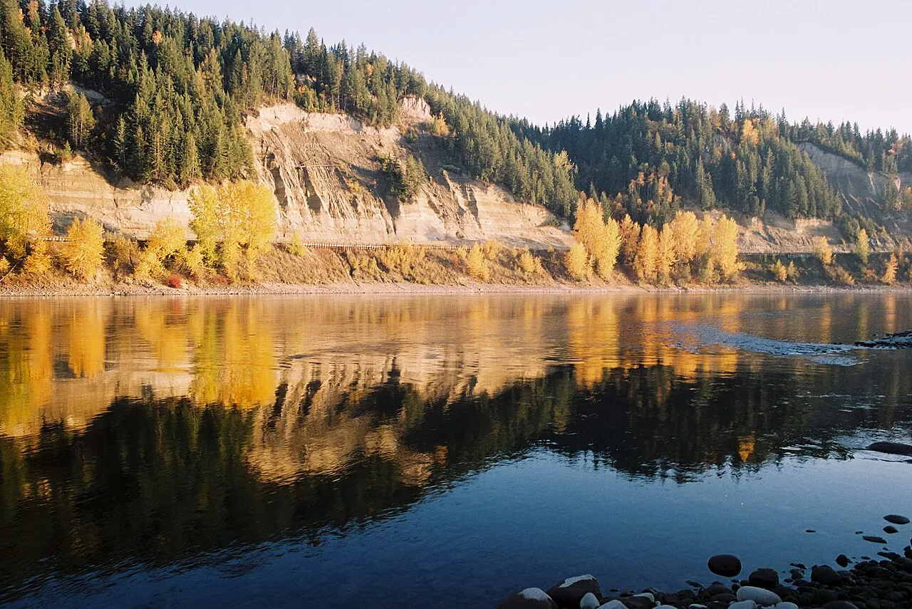
- Trembling aspen, paper birch and black cottonwood, which turn the hillsides gold in late September.
The forest is why Prince George became a sawmill and pulp town. It also provides wild edibles including blueberries, saskatoons, raspberries, cranberries and morel mushrooms. East of the city the forest changes dramatically: the wet valleys toward McBride hold the inland temperate rainforest, home to thousand-year-old western redcedars at Ancient Forest/Chun T’oh Whudujut.
Wildlife is part of daily life. Moose, black bears, deer, beavers and bald eagles are regularly seen on the city’s edges and in its greenbelts.
Lakes and the Arctic divide
The land around Prince George is dotted with lakes, many within a 30- to 60-minute drive:
- West Lake, about 22 km southwest, with a day-use provincial park.
- Tabor Lake, just east of the city near Tabor Mountain.
- Ness Lake, about 35 km northwest, with a regional park and beach.
- Purden Lake, about 64 km east on Highway 16, with a provincial campground.
- Summit Lake, north on Highway 97, sits on the height of land between the Fraser and the Arctic-bound Peace and Mackenzie river systems. The Giscome Portage trail crosses this divide.
See summer and lakes for swimming, paddling and fishing ideas.
Climate in brief
Being inland, at elevation and far north means cold winters and warm summers. The January daily mean at the airport is about −7.8°C and the July mean about 15.9°C. The full picture is in our climate guide and live conditions are on the weather dashboard. In summer, also keep an eye on the wildfire dashboard.
Common questions
What rivers meet in Prince George?
The Nechako River flows in from the west and joins the Fraser River at Prince George. The Fraser then continues south for hundreds of kilometres to the Pacific at Vancouver.
What is the elevation of Prince George?
About 575 m above sea level in the valley bottom downtown. The surrounding plateau, where the airport and UNBC sit, is 100 m or more higher.
Is Prince George in the mountains?
Not quite. It sits on a rolling plateau between mountain ranges. The Rocky Mountains are visible on clear days to the northeast and the Cariboo Mountains rise to the southeast.
Does Prince George flood?
Low-lying areas near the confluence can flood during spring freshet or when ice jams form in winter, as happened on the Nechako in 2007–08. Check the rivers dashboard and official BC River Forecast Centre advisories for current conditions.
Sources
More in explore pg
- History of Prince George, BCA timeline of Prince George history, from the Lheidli T’enneh homeland at the confluence to a fur post, a railway boomtown and a northern capital.
- Lheidli T’enneh First Nation: people of the confluenceThe Lheidli T’enneh, on whose traditional territory Prince George stands: their name, history, the 1913 removal and Lheidli T’enneh Memorial Park.
- Fort George and the railway boom: how Prince George beganSimon Fraser’s 1807 fur post, the South Fort George and Fort George rivalry, the Grand Trunk Pacific’s 1914 arrival and 1915 incorporation.
- Glacial Lake Prince George: why the city sits in a bowlHow ice sheets, a vanished glacial lake and two rivers carved the Prince George bowl, its silt cutbanks and the benches the city is built on.
- Prince George climate: weather by month, records and normalsPrince George climate normals for 1991–2020: monthly highs and lows, snowfall, rain, sunshine and record temperatures, plus tips for every season.
- Prince George neighbourhoods: a guide to the city’s areasA guide to Prince George neighbourhoods: Downtown, the Crescents, the VLA, College Heights, the Hart, South Fort George, Miworth and Blackburn.
